Bone-chilling Arctic air gripped much of the eastern United States on Saturday, while lake-effect snow threatened to disrupt post-holiday travel in parts of the Great Lakes region.
A frigid air mass that swept south across the northern Plains and Midwest into the South and East Coast is expected to linger through the weekend, bringing the coldest temperatures since last winter, according to the National Weather Service’s Weather Prediction Center.
A wide stretch of the eastern US is forecast to experience temperatures dropping 15 to 25 degrees, from Minnesota to Texas, as chilly air moving over the record-warm Great Lakes triggers the season’s first major lake-effect snow event.
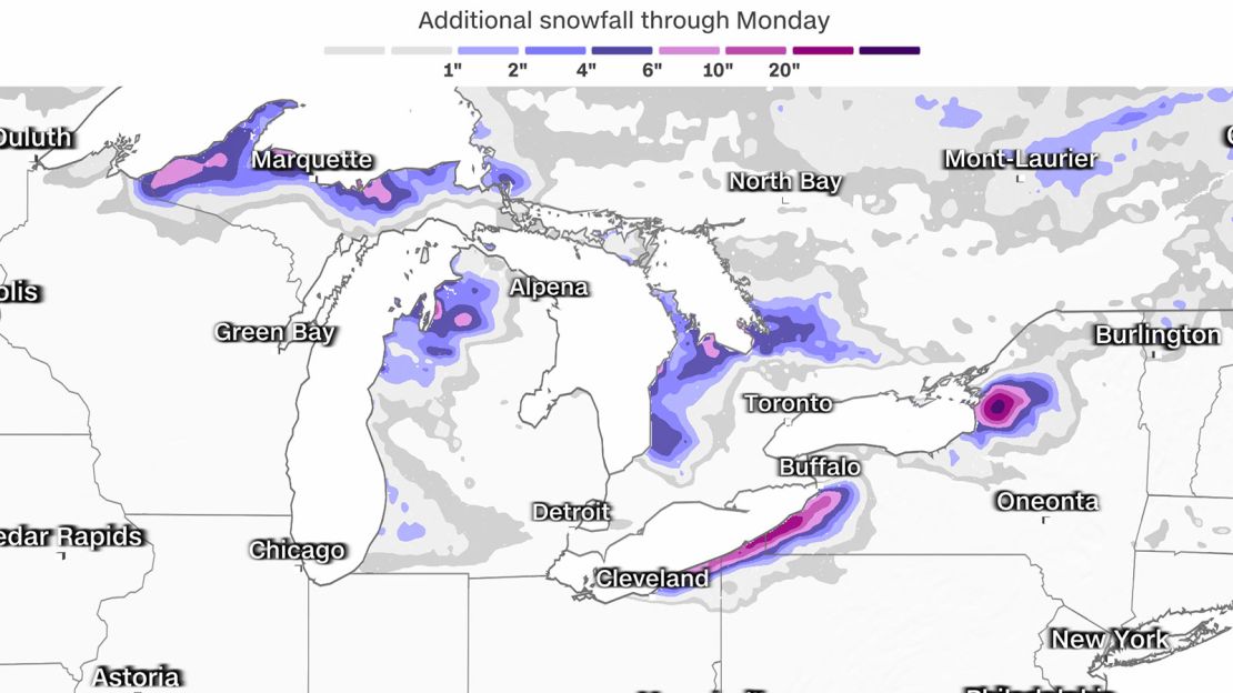
Winter weather alerts were in effect for nearly 10 million people on Friday, with widespread snow totals expected between 6 to 12 inches. However, accumulations of 4 to 6 feet are possible this weekend in concentrated, narrow bands of snow.
High temperatures this weekend will feel more like mid-to-late January in Chicago, Indianapolis, Atlanta, Nashville and Tallahassee. Nearly 70% of the US population is expected to experience temperatures below freezing over the next few days.
Especially frigid conditions are expected Saturday morning in the northern Plains and Upper Midwest, with wind chills well below zero. This could increase the risk of hypothermia and frostbite, according to the Weather Prediction Center.
“Wind chills across much of the Dakotas and Minnesota will be below negative 15 with portions of North Dakota as cold as negative 30-40,” the center said.
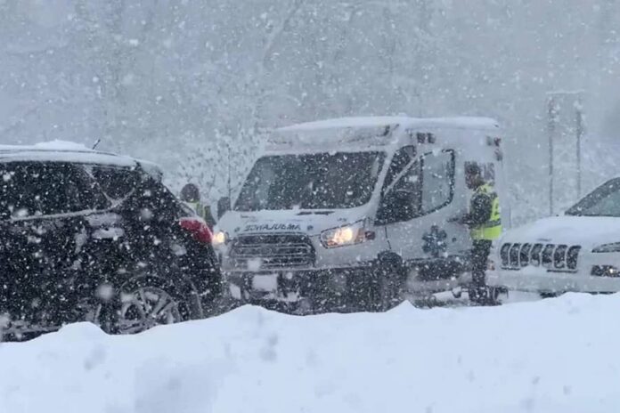
Michigan, New York and other parts of the Great Lakes region remain on alert as lake-effect snow continues to create near-whiteout conditions, leading to dangerous traffic snarls in some areas since Friday.

Forecast snowfall through Monday around the Great Lakes region is shown. CNN
Residents of Watertown, near Lake Ontario in western New York, could be digging out from up to 70 inches — nearly 6 feet — of snow by Monday, according to forecasts. Jefferson County, where Watertown is located, is one of several areas under the state of emergency New York Gov. Kathy Hochul issued Friday due to the threat of lake-effect snow.
Northeastern Ohio and northwestern Pennsylvania are also bracing for significant impacts from prolonged, heavy snowfall.
“Accumulations will measure in feet in the hardest hit areas, with breezy conditions leading to drifting snow as well. Travel will be difficult to impossible,” warned the Weather Prediction Center.
The heavy snow has already prompted officials to close portions of several major highways in New York and Pennsylvania, including sections of Interstate 90.
A driver in Erie, Pennsylvania, told CNN he saw state police rescuing motorists trapped in snowdrifts.
Meanwhile, the Buffalo Bills are set to face the San Francisco 49ers in Orchard Park, New York, on Sunday, with game-time temperatures expected to hover around 26 degrees.
Erie County officials expect the heaviest snow to have stopped falling over Highmark Stadium by game time, they announced Friday.
“However, it is possible in the most likely scenarios, there will be 20 to 30 inches of snow that will have fallen at the football stadium by game time,” Erie County Executive Mark Poloncarz said at a Friday news conference.
Ahead of Sunday’s game, the Bills posted to X requesting fans to help shovel snow at the open-air stadium.
While the heavy snow may cause concerns for those traveling, the game is unlikely to be postponed, according to Poloncarz.
“The game will go on,” he said.
By Ashley R. Williams, Taylor Ward and Holly Yan, CNN

