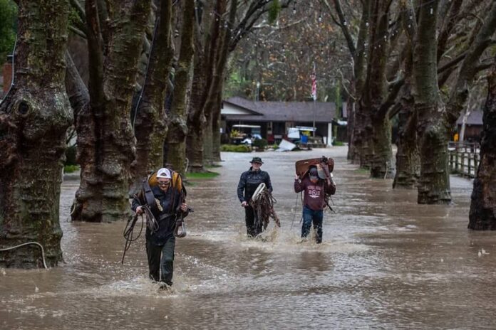
On Tuesday evening, a powerful storm hit the northwest U.S., bringing fierce winds and heavy rain that caused widespread power outages and downed trees, resulting in at least one fatality.
The Weather Prediction Center warned of excessive rainfall risks lasting until Friday, and hurricane-force wind alerts were issued as the strongest atmospheric river—a significant surge of moisture—this season overwhelmed the area. This storm is classified as a bomb cyclone due to its rapid intensification.
In northwest Washington, fallen trees caused damage to homes and blocked roads. Tragically, in Lynnwood, a woman lost her life when a large tree collapsed onto a homeless encampment, according to South County Fire’s statement on X. Meanwhile, in Seattle, a tree fell on a car, trapping someone inside temporarily; thankfully, they were later reported to be in stable condition.
Bellevue’s fire department tweeted that trees were toppling throughout the city and urged people to seek shelter on the lowest floor away from windows and avoid going outside if possible.
By early Wednesday morning, over 600,000 homes in Washington State were without power according to poweroutage.us. However, this number fluctuated significantly during the night as various weather and utility agencies faced internet outages and technical difficulties while trying to provide updates about the storm.
It’s uncertain how accurate those figures are. Additionally, more than 15,000 people lost power in Oregon and nearly 19,000 in California.
As for wind speeds? The peak gusts reached an impressive 101 mph (163 kph) off Vancouver Island’s coast in Canadian waters by 8 p.m., according to the National Weather Service in Seattle.
On Oregon’s coast that same evening, gusts hit up to 79 mph (127 kph), while Mount Rainier recorded winds at 77 mph (124 kph).
According to the weather service, winds are set to pick up in western Washington as the evening goes on. They’re warning folks on the West Coast to be cautious about trees during these high winds. Their advice? Stay safe by steering clear of outside rooms and windows, and drive carefully!
Over in northern California, they’ve issued flood and high wind watches with some areas around the San Francisco Bay, North Coast, and Sacramento Valley expecting up to 8 inches of rain.
This could lead to some dangerous flash floods, rock slides, and debris flows—definitely something to keep an eye on!
In the northern Sierra Nevada above 3,500 feet (1,066 meters), a winter storm watch is in effect where they’re predicting as much as 15 inches of snow over two days.
Forecasters say mountain areas could see wind gusts exceeding 75 mph (120 kph). Meanwhile, a flood watch is active for parts of southwestern Oregon until Friday evening.
Also, rough winds and seas have caused a ferry route between Port Townsend and Coupeville in northwestern Washington to be suspended.
Starting Tuesday afternoon, there’s even a blizzard warning for most of the Cascades in Washington—including Mount Rainier National Park—where we could see up to a foot of snow along with wind gusts reaching 60 mph (97 kph). So if you’re planning any travel across mountain passes, it might be tough or even impossible!

